Bharat Global Time
Wait… what? Did India’s coastline just stretch by over 3,500 kilometers overnight?
That’s the question many Indians are asking after a wave of headlines, social media posts, and even some official murmurs claimed that India’s coastline is no longer 7,517 km… but now measures a whopping 11,000 km.
So, is this a geographical miracle, a data correction, or just a classic case of misinformation gone viral?
Let’s dig into what’s really going on.
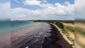
India’s Coastline: What We’ve Always Known
For years, geography textbooks and government reports have stated:
- Mainland coastline: ~5,422 km
- Island territories (Andaman, Nicobar, Lakshadweep): ~2,094 km
- Total official coastline: 7,516.6 km (as per MoES and IMD)
This figure is based on basic aerial measurement, also called the straight-line method, ignoring curves, indentations, estuaries, and minor contours.
But now, a new method of calculation is changing how we see the coastline entirely.
What’s Behind the New 11,000 km Figure?
The new figure comes from using “fractal geometry” or “high-resolution geospatial mapping” — a method that follows every curve, bay, creek, and inlet along the coast, including minor shifts in the shoreline due to erosion, tides, and climate change.
This is often referred to as:
- The “detailed coastal perimeter”
- Or “actual coastline” vs. “map coastline”
So, no — India’s landmass hasn’t physically expanded, but how we measure the coastline has changed.
Imagine tracing the edge of a torn paper with a ruler versus a magnifying glass — the second method will naturally give a much longer reading.
Why This Change Matters
You may wonder: Why bother with a longer measurement? Does it really matter?
Yes, it does — for multiple reasons:
1. Coastal Security & Surveillance
A longer, more accurate coastline means more marine zones to protect, especially in a world of rising naval threats, smuggling, and illegal fishing.
2. Blue Economy
India’s focus on the Blue Economy — using ocean resources for sustainable development — depends on understanding the true extent of maritime boundaries and coastal reach.
3. Disaster Management
Accurate coastline data is vital for cyclone tracking, tsunami preparedness, and flood mapping.
4. Climate Impact Studies
Rising sea levels, coastal erosion, and saltwater intrusion are better studied when we know exactly how much coastline is exposed to the ocean.
My Take: A Case of Scientific Precision, Not National Expansion
Let’s be clear — India hasn’t suddenly “gained” more coastline in the way we might gain land through reclamation or erosion.
This is more about how we count, not how much we own.
Think of it as moving from 2D to HD. We’re not expanding the picture — we’re just seeing it more clearly and completely.
Misinformation Alert: Beware of Viral Claims
Some social media influencers are spinning this into bizarre theories:
- “India secretly reclaimed land!”
- “Proof of India’s rise as a superpower!”
- “Modi doubled India’s coast overnight!”
Let’s not fall for WhatsApp University degrees.
The actual story is more scientific than sensational — and that’s okay.
Final Word: Knowledge Is Power, Not Panic
Yes, India’s coastline may now measure 11,000 km — but not because of tectonic shifts or divine intervention. It’s because of modern tools, accurate mapping, and scientific recalibration.
And in a time of rising geopolitical tensions and climate risks, better coastal data could be the key to smarter defense, stronger policies, and safer communities.
What do you think? Should geography textbooks be updated with this new figure? Is the longer coastline a good thing — or does it bring more responsibility? Let’s talk in the comments